Overview
As part of the FAIR-EASE knowledge-building and sharing, a webinar dedicated to openEO was organized by the Copernicus DataSpace Ecosystem (CDSE) to introduce researchers and infrastructure providers to the concepts, tools and practical applications of openEO.
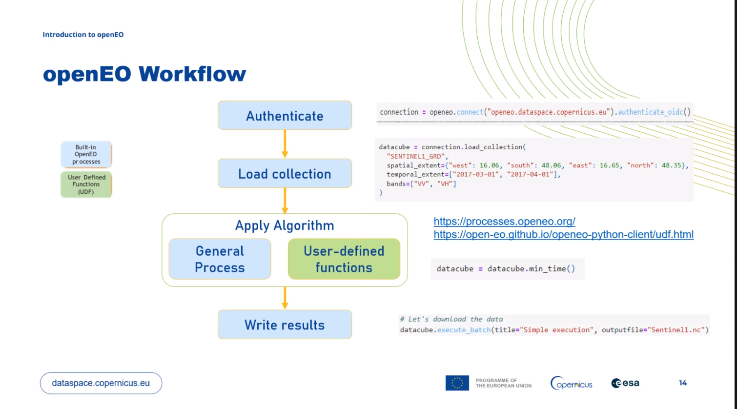
OpenEO is a standardized web API designed to simplify access to and processing of Earth Observation (EO) data across diverse cloud-based backends. It provides a unified and language-agnostic interface that enables users to define, execute, and monitor complex remote processing workflows on datacubes. OpenEO provides a discovery interface (OpenEO Discovery) that allows users to access data and metadata exposed via a SpatioTemporal Asset Catalog (STAC) access point.
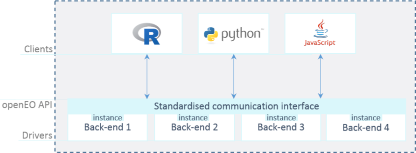
With openEO, users can apply processing functions directly on the data where it resides, chaining operations into workflows that are executed server-side, without needing to download large datasets. This approach is particularly well-suited for cloud-native and scalable processing, and aligns with FAIR-EASE’s goals of supporting interoperability between Earth System domains.
The API is fully compatible with ARCO formats such as Zarr and COG, as well as with STAC metadata, facilitating seamless integration with modern EO data catalogs and storage solutions.
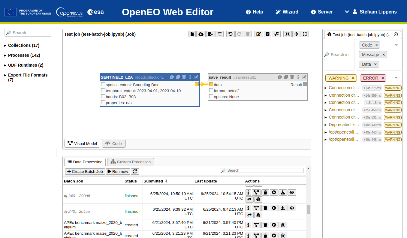
An online Web Editor is also available for users to interactively build, test, and submit openEO workflows through a graphical interface, lowering the barrier for non-expert users and fostering reproducibility.
OpenEO is currently being standardized within OGC, and momentum is growing towards the creation of a federation of openEO-compliant backends, enabling interoperability between EO platforms on a European and global scale.
Implementation on Examind Community
OpenEO has been implemented, during the FAIR-EASE project, within the Examind Community platform, an open-source geospatial framework developed and maintained by Geomatys. Examind Community is already compatible with OGC services (e.g. WMS, WCS, WFS) and OGC API (e.g. Common, Coverage, Processes). It can also manage geospatial native or ARCO formats, from local or remote storage (e.g. HTTPs, S3).
- Examind Community website : https://
www .examind .com /en /examind -community/

Figure 4:openEO on Examind Community
The OpenEO standard consists of two essential components: OpenEO Discovery and OpenEO Processing, both of which have been implemented in Examind Community.
The first one is an access point to a STAC catalog. It allows data and metadata to be exposed via a user-accessible catalogue. This is accessible in Examind via a WCS service (create a WCS service, associate data with this service, and a STAC access point will be opened with this data). For more detailed information about the STAC specification, you can refer to the official documentation[13].
The second component is the core of openEO, the processing part. It enables users to access, modify, create and execute workflows by linking unit processes. In Examind, this service is accessible via WPS (turn on a wps service, and an openEO access point will be created). For more detailed information about the OpenEO (processing part), you can refer to the official documentation available openEO website[14].
Here is an example with an Enhanced Vegetation Index (EVI) process via Examind. All openEO processes / workflows in Examind will follow these steps. In this example we are calculating an EVI on a forest area, but any other process to be run on a data item will follow the same procedure.
Examind offers different processes (‘basic building blocks’) for
creating workflows. These include operations from the openEO standard,
such as load and save to respectively load data into the graph and
save the result in a format (e.g. GeoTIFF or NetCDF). Examind also
offers a list of mathematical operations, on numbers or coverages (e.g.
multiplying the values of a coverage by a value), and other specific
processes.
To access the list of data and processes that can be used via openEO, you can use the user interface (via a web editor client) or the STAC / OpenEO Process API.
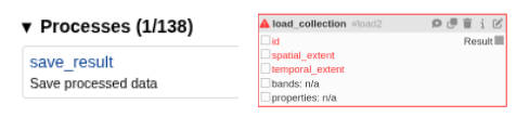
Figure 5:openEO processes on Examind
Once you have a list of the data you want to use and the processes you
want to use, you can create your first graph. In this graph, you will
chain processes to create the expected result. In the example of the EVI
calculation, we will transfer the formula: 2.5 * (NIR - RED) / (1 + NIR + 6 * RED + 7.5 * BLUE), using mathematical operations in openEO.
Once this first graph has been created, we will execute it. To do this, we need to describe the parameters that the graph must use. For example, the source data identifier, the type of file used for output, the extent, etc..
The graph can be executed in one of two ways: synchronously or asynchronously. Synchronously, the request will be launched and you will receive the result in return. Asynchronously, a job will be created and will have to be executed. You can then query the job to find out its status and the result once it has finished.
Here is the json requests for the EVI graph, execution of the graph, and the result :
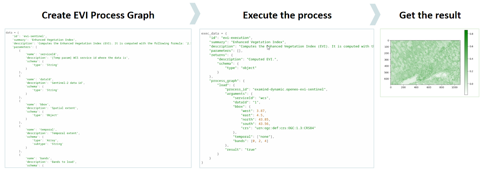
Figure 6:openEO flow on Examind
More information (Jupyter notebook + documentation) on Examind Community
OpenEO endpoint is available on
https://
There was no immediate practical use for the pilots, but the potential for further developments are significant.
Another example with Copernicus
To give another example of openEO processing, we can use the Copernicus platform. You can find all Sentinel data directly here, as well as processes that are already available. Below is an example of a workflow for calculating an NDVI from Sentinel data.
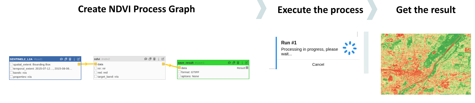
Figure 7:openEO flow on Copernicus (NDVI calculation)