TerriaMap is an Australian Open Source web application for building web-based map viewers, Atlases and Digital Twin Interfaces. The platform was originally developed by CSIRO (Australia’s national Science Agency). It is similar in concept to the European EDITO digital twin interface. TerriaMap is now supported by a commercial Support company Terria Pty ltd. (terria.io)
Terriamap was used in the “Terriamap Challenge” at the FAIREASE Hackathon in Brest in March 2025. The hackathon challenge explored how diverse environmental datasets (e.g. Argo, Omics data) and OGC and other data services (from Examind, Thredds, ERDDAP, Beacon) could be visualized and interacted with in the TerriaMap web application, allowing for cross disciplinary integration of data services from the FAIR-EASE use cases and infrastructure.
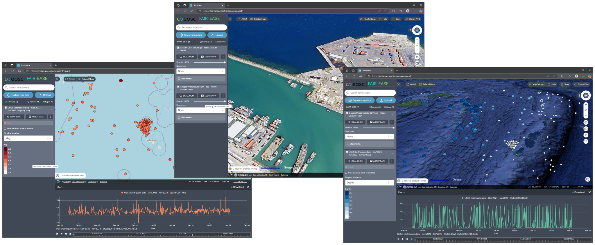
Figure 1:Terriamap 2D and 3D display modes
Terriamap is based on the Terriajs javascript library, the source code
and user configurable files are published on Github in the [TerriaMap
github repository].
Documentation on the installation and configuration of Terriamap and the
various supported data services and data sources is available at
https://
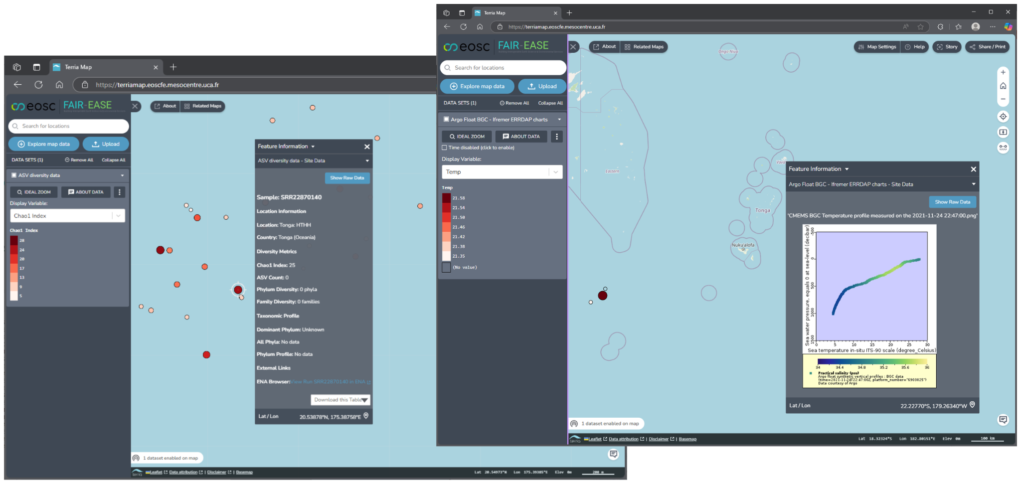
Figure 2:Terriamap displaying OMICs metadata and ARGO profile data from ERDDAP
An instance of Terriamap configured with example datasets from the Brest
Hackathon is published on the the University Clermont Auvergne(UCA) at
https://
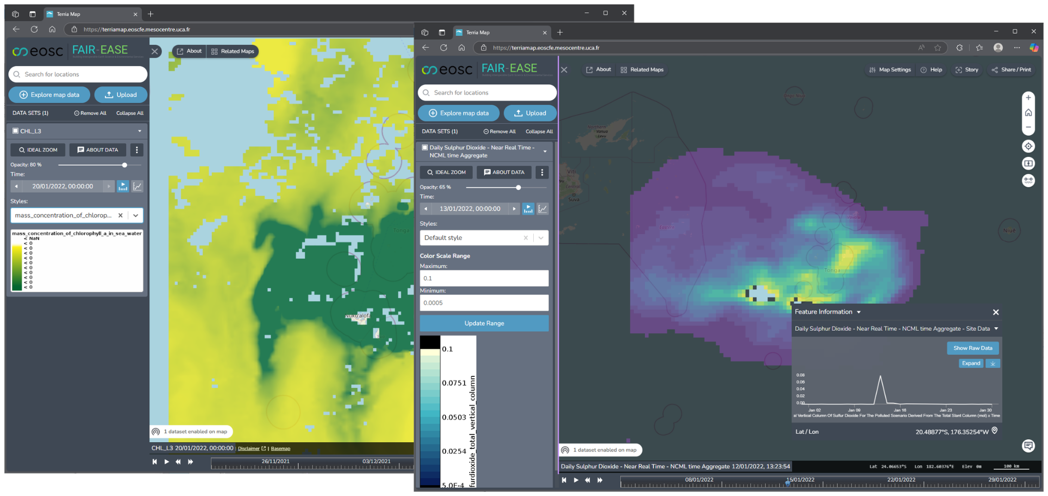
Figure 3:Terriamap displaying CMEMS Chlorophyll data from Examind and SO2 data from Thredds
The Terriamap example configurations compiled during the Hackathon are
available on
https://